Sunday, May 28, 2006

Riding Up That Hill


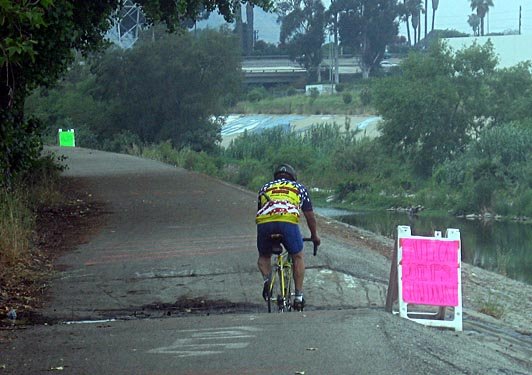
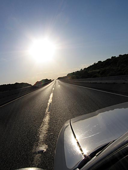
I wake up every morning and look out at the Palos Verdes Peninsula, which sticks up about 1500 feet above sea level (where I live). But when I go cycling, because the roads from here to Palos Verdes run pretty ratty, I usually ride south and east, along the beach, rather than west and north, toward the hills.

Lately it has come to my attention that my legs turn to spaghetti on real hills. Also, it crosses my mind that even on the flat I'll probably cycle better if I train in hills. (I grew up in Northern California, where real hills were easy to come by.)

So I got up this morning with the idea in mind of rectifying this unfortunate omission from my training schedule.

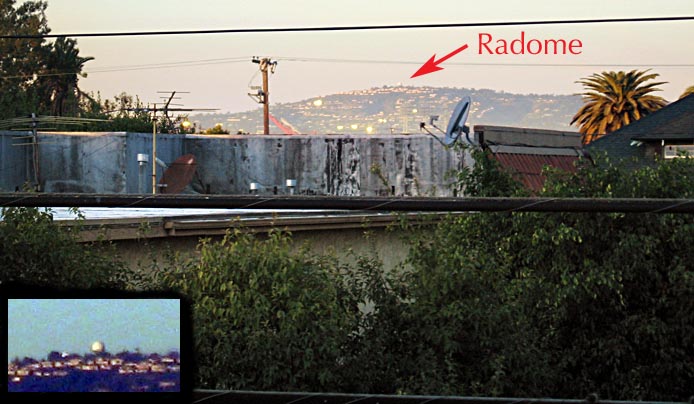
Here's the target, as seen from my balcony. (Actually, I have a feeling what I'm calling the radome here is actually a big white water tank. Same general area on the hill, though. We specialists call that the "top.")

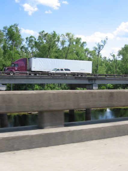
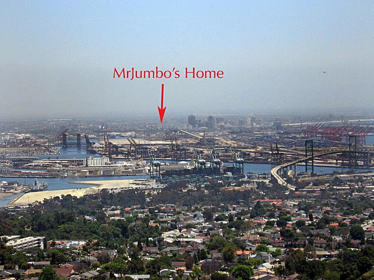
You can see what I mean about ratty roads between my place and the hilltop. It's mostly industrial neighborhoods, with everything lying in the gutter that you can imagine falling off a truck. The bridge on the right, by the way, is the Vincent Thomas suspension bridge leading into San Pedro (in the foreground, out of the frame to the right). If you follow that road off into the distance, you'll find, if you look really closely, the Gerald Desmond Bridge, an arch-shaped steel bridge slightly to the right of the arrow tip. That's on the same highway, but it's much closer to my home. I was nearly arrested once for taking pictures from that bridge, but that's a story for another time.


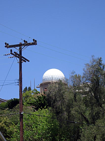
The radome, from a closer vantage.


When you get up to the top of the hill, you can look north and see the northern (west-facing) beaches of Los Angeles: Manhattan Beach, Redondo, Santa Monica, Venice, and so on. Below Palos Verdes are the beaches I normally ride, which mostly face south: Seal Beach, Sunset Beach, Huntington Beach, and on into Orange County.

The ride turned out to be a good trial run. I'm still figuring out the best route. Next time I might tweak it to get to a somewhat different destination, but this worked really well for today. About three hours after I left home, I was back unlocking the back gate again. Enough to get the heart unclogged without depleting me completely.

The Color Purple


This spring, purple seems to be the color of choice. I saw these flowers more than once on my ride today. (Notice there are actually more purple flowers at the foot of the tall ones.) Thistles added purple, and purple iceplant. In my neighborhood, and to some degree out at Palos Verdes, it's jacaranda season, which means on some streets you ride under a canopy of purple that stretches from one side of the street to the other. On Palos Verdes Peninsula, whole hillsides were covered in purple daisies. Each purple adds a slightly different tone to the pallette, but the combined effect is breathtaking.

Catching Up

Last weekend, about 24 hours after getting back from a 6,000-mile driving trip, I saddled my bicycle and drove 35 miles north to get on a trail that would take me very nearly back home, then turn me around to ride back to my car, at which point I'd drive home again.

I know, it sounds a little pointless.

But I needed to stretch my legs.

I didn't take too many pictures. The ride was the L.A. River Ride, sponsored by the Los Angeles County Bicycle Coalition, so the route focused on the mostly terrific trails along the well-groomed Los Angeles River.

Toward the north end of the river, however, there were a few spots that would be nice to fix for riders:


I'm not sure what "DIPS" refers to in this usage. The postpositive position in English grammar is frequently reserved for a vocative usage; in other words it often makes reference to the party being addressed (as in "You, sir, are an ass.").


Along the way, we actually paused to let another "alternative" form of transportation go by.


Easily the first third of the 70-mile ride went very smoothly, if somewhat upwind. I got lost at one point following someone who I thought knew his way (turns out it was his first time on the ride too), but got back to the route with no major mishaps and started catching up again. The pace was excellent, and by the time we hit the narrow river trails the pack had thinned out to where there wasn't much congestion.

Toward the end of the southward leg I noticed a little cramping in my right leg (accelerator pedal); I massaged it away and made sure I stayed up on fluids. At the rest stop I checked my nutrients to make sure I was getting enough of the potassium, magnesium, and calcium that some say will help avoid cramping (these are the "electrolytes" that replenish the neurotransmitters so they can carry the message to your leg muscles that it's O.K. to relax now). On the way north again we flew like the wind (which was behind us now).

But by the end of 70 miles, after not being in the saddle for two weeks, I have to say I was feeling the work. Now both my legs started cramping. Thankfully it wasn't serious charley-horse cramping, just twinges on every stroke. Aside from checking fluids and nutrients (I had picked up free Clif Shots at the rest stop, which at least made me feel better), I couldn't do anything but pace myself and keep shoving. It never got terrible. I forced myself to catch a second wind and shot off toward the end of the ride. Got there and had to stand in line 15 minutes to collect my barbecue lunch. I could have gone further but didn't mind stopping at all.

I could have taken the 45-mile version of the ride (go all the way south, then take public transit back), but I was glad I had stretched and taken the full route. Along the way I also met some folks who rode about the same pace, which made this ride go faster and may be good for future rides too.

Tuesday felt some minor stiffness that I'm sure came from this ride, but I just jumped back on and rode it off before work. This weekend (Memorial Day) we have three days of sunshine, and it looks like some long trails are in the cards again.

Saturday, May 27, 2006

The Opposite Pole

My brother serves on his condo board. I'm smarter than he is. (Fair's fair. He has more hair.) I turned down the offer. He goes to frustrating meetings and actually has to do something about things. Our meetings look more like this:


We have a very efficient board. You'll notice our staff didn't waste any paper printing a brand-new sign. We just re-used the one from last month, because it hadn't been rained on much since it was originally posted.

Please don't think we're not getting anything done around our condo. The board is in fact evaluating replacement windows for the entire complex. (And yes, as a nonmember, I've had plenty of input.) But until we have some sample windows installed, there's no point having a meeting.

Just as well. I worked till 7 that night, so I would have missed the meeting if there had been one.

Friday, May 26, 2006

This Number Is out of Order


Because my brother put up a note about telephone rates today, I have to post this image.

It's the tariff schedule for California long-distance rates a few years back.

It used to hang in my father's office in San Francisco. No, he had not been around when this sheet was current. But he used to use it to illustrate various points about how business is conducted. For example, he would point out that since public utilities commissions got involved at various levels, the telephone company could no longer print on their tariff (which by then filled several volumes) "Rates Subject to Change Without Notice." I still have a video of a business presentation my father made where he mentioned this chart.

This now hangs in my mother's house in Northern California. I took a picture of it last Christmas when I was, appropriately enough, talking on the phone long-distance.

Sunday, May 21, 2006

The Californian


It was a good trip, but it was good to be home and see a proper California sunset again. The skyline in the distance is Long Beach.

In South Carolina last weekend we were discussing the word "resplendent" and how often anyone gets a chance (or not) to use it in an everyday conversation. I'd say a sunset like this offers one such opportunity.


A few statistics:

Hours on the road: Who knows?
Miles on the road: 5,963 (10 traveling days)
iTunes played from Lafayette to Long Beach: 390, in random order (out of a total 1,601 available for the trip)
Longest day: Definitely the last, when I woke up in Texas and went to sleep in my own bed. Slightly over 1,000 miles.
Photos taken: 751
Good photos taken: You be the judge. I posted some of the better ones, and a lot of them are less than perfect.
Miles ridden down the L.A. River on a bicycle two days after I got back: 70.6. But that's a whole different story, for a later entry. Sure gets the road kinks out. Leaves you with a whole new set.
Weddings attended: 1 (but it was a good one)
Customers visited: 10
Guys glad to be back home after a long trip: 1 (but a good one)

By the Time I Get to Phoenix


The sun was pretty much gone before I left New Mexico. To get back to California, I could have turned west at Casa Grande and taken the road out to San Diego by way of Yuma. That would have been about the same mileage, and tempting if I was going to see new scenery. I've driven the Phoenix road before. But since it was all going to be driven by night, I decided to stick to the easy road, the one I knew.


Storm gathers in southern New Mexico.


I studied and studied, but as hard as I tried, I couldn't see anything kicking up this dust but the wind. Normally there's a truck at the head of a dust stripe like this, heading pell-mell down a dirt road. I think this was just Ma Nature.


This one definitely had a truck at the head of the comet.

Yuck(a)

On the way out and back, across Arizona, New Mexico, and western Texas, the yucca were in full spring bloom, fun to see. These pesky critters are harder to photograph than you'd think; they lurk by the side of the road and dart by fast when you point your camera at them. Yes, a photographer could stop and do a proper study, but I couldn't see any point in abandoning the rules of roadside photography.


Across the Rio Grande

All things come to an end, even Texas. All my way west my heart jumped as I crossed all the same things I had passed on my way east: the Pecos River, the Continental Divide, the Mississippi, Shoney's. Each landmark I went by brought me one step closer to home. (I was on a different route home, to the south of the route I took east, but the interstate highway crossed many of the same boundaries.)


Some cross the Rio Grande to go to Mexico. I crossed it after I was in New Mexico, hurtling west, the direction they say loose wheels roll.


After taking days to get through Texas, New Mexico seemed like hardly a blip before I was in Arizona. The last time I'd had to change my watch was when I left Georgia and hit Central Time in Alabama. On this day I changed my watch twice more--once when I hit the part of Texas that uses Mountain Time, and again when I hit Arizona, where (although they're on Mountain Time), they don't observe Daylight Savings, so in the summer the time is the same as California's.


And I must have missed a turn somewhere down in Phoenix, because suddenly looming up before me was a big sign that said "Welcome to California." Had I crossed the Colorado too?

Yup, It's Still Texas

I still had a fair amount of Texas to cover. This is a very lightly populated part of the state; I've driven through when there was hardly another car on the road. You get to a point where literally the only station you can pick up on the radio is one thready AM station with a preacher on it.


The geology is laid bare; not much foliage is there to cover it. You see cinder cones, crumpled layers of sediment in roadside cuts, wide alluvial plains, river-cut clefts. Every time you come up over a rise, you see a new landscape, with its own geology and its own cloud patterns to match. I won't even go into the variation in insects from valley to valley; you'll just have to check out the splatter shapes on the windshield as I go from place to place.


Out of nowhere, suddenly a stream of bikers, on a ride somewhere. Almost as soon as they came, they were gone. I'd estimate about 100 bikes. I was put in mind of friends back in California who go on rides like this.


Everything really is bigger in Texas, or at least the landscapes are.


The mountains here are actually in Mexico. It's that close to the road as you come up toward El Paso. The Rio Grande must be right up at the base of the mountains. The Border Patrol keeps a visible presence on the highway, and there are a couple of checkpoints for vehicles leaving the El Paso neighborhood.


Again, these mountains are in Mexico. Ciudad Juarez is just across the river from El Paso, which is in the foreground. See the words written up on the hill beyond one of the foreground buildings? I believe they say, in Spanish, "The Bible is freedom--read it!"

Feeling Presidential

Odessa, Texas, a half a shake up from Midland, where I spent the night, boasts a place I was told is the only museum in the U.S. dedicated to all the Presidents. I'd been to the Clinton library in Little Rock, and honestly when I pulled off the highway I thought I might be seeing the Bush presidential library, but no. This was in some ways even better.

It started with a fellow who had collected a significant library on the topic of U.S. Presidents. Theses, speech notes, memorabilia, historical volumes--a private library, but a rich research trove. The library is still the core of the Presidential Museum and Leadership Library, but since setting up on property adjacent to the university they have also expanded to include displays on every U.S. President.


The displays don't go deep, because there's not room for that, but each includes a brief biography of the President, often including information about that President's First Lady, and each display contains a few pointed pieces of memorabilia--a campaign button, an autobiography, war mementoes, White House china. On the walls all over are significant quotations from all eras of the Presidency, and the walls of each display tell a little about American history of that President's time.


Not bad. I think I was the only visitor there that day. A school group had come through before me. I suppose not many travelers take the time to stop in Odessa to see this. But researchers over time will probably add to the collection and make it an even better research hub. I should add that while I was there I saw at least four staff members, each of whom took the time to help me in different ways. I suppose at least two of them were volunteers, but still I felt spoiled.

On the other hand, everyone I asked where the famous Odessa steps are just gave me a blank look. I told them I was sure they must know; there's a special ADA ramp now for baby carriages and such. Didn't seem to ring any bells. I told them I'd get some pictures from the Internet and send them a montage to see if they recognized the scene.

Oh, and the museum staff really do have a couple of favorite Presidents. George Herbert Walker Bush (the father) came from Connecticut to Odessa as a young man to seek his fortune in the oil fields, and he did quite well. He moved around a good bit, and spent more time in Midland, but Odessa still claims him as one of their own. George Walker Bush (the son) was born in Connecticut, but says he was reared in Texas, both Odessa and Midland. Laura Bush's mom still lives in Odessa, and I was told that Laura comes through town regularly to visit, often without much hullabaloo. Probably she appreciates having a place she can go and get some quiet.

Also it's probably warmer than Washington in the winter.

This is the first house the Bushes owned, after skipping from apartment to apartment. Note the kid on the tricycle on the left.


Here, the house's entertainment center, something that will be familiar to most folks today. I checked the disks on the phonograph. They were not marked with a speed, which means they must have been 78s. After 45 and 33 rpm records were developed, all records would say what speed to play them at. There was also no indication on the turntable of how to switch speeds.

I looked at the back, but I couldn't see anywhere to plug in my iPod.


These pesky little critters are all over the property. Genuine prairie dogs. The lady who showed me around said they left the lawn looking like it had been mowed with a machete.

Friday, May 19, 2006

Reflections and Refractions


Yeah. Like I could make any wise-off comment that would do anything but tarnish how spectacular the world can look when you leave it unframed.

Waffle Across Texas


The hotel I'm staying at, in Midland, has a waffle iron shaped like Texas.


If I were the Waffler-in-Chief (what did you think W. stands for?), and if I were from this part of Texas (he is), I wouldn't want hotels reminding people what a Texas-sized waffle looks like.

I didn't have any waffles. My mother's and father's excellent sourdough waffles from when I was a kid have ruined me for most other waffles forever. Particularly Texas-style waffling leaves a bad taste in my mouth these days.

Something New to Tilt At


I have now seen windmill farms in three states I'd never spotted them in before: New Mexico, Oklahoma, and Texas. These are part of a biggish installation south of Sweetwater, in West Texas. Dusty Springfield, eat your heart out.

Another Roadside Distraction

In the East, up to somewhere in Louisiana, it's very common to have a thick row of trees lining the highway. The traveler doesn't get any sense of what the surrounding landscape looks like until they take an offramp and see farms or marshes or a city or hills or the shore.

You can tell you're starting to hit the West when the trees fall away and the vistas open up. In Texas you can see for miles.


Can You Picture That

Here and there I was able to squeeze off a shot that wasn't obscured by a passing truck or the airbags inflating. Louisiana looks better than these pictures show.


Sunsets last forever down here. The light lasts and lasts into the gloaming, as I head further west. Around nightfall I made the Texas border. This time I'm crossing the girth of Texas, not the panhandle, so it will take a couple of days.

We've Got to Get Out of This Place


After you get back to driving on dry ground, you start to see these signs again. If you look sharp, you'll notice them also on the opposite side of a divided highway in some places. On the opposite side, they face away from the usual direction of traffic. In a hurricane, both sides of the highway would be used for traffic bound inland. Folks driving to the shore would need to take another road.

Standing on a Corner in Lafayette . . .


. . . in the state of Louisiana. I thought this would be a perfect spot to stop, grab a bite, and take a photo based on the Paul Simon lyric from the Graceland album:

Well, I'm standing on a corner in Lafayette
State of Louisiana
Wondering what a city boy can do
To get her in a conversation
Drink a little red wine
Dance to the music of Clifton Chenier
The king of the bayou

Later he's "Standing on the corner of Lafayette, across the street from the Public, heading down to the Lone Star Cafe."

I know who Clifton Chenier is, so I figured it would be no problem to find the Lone Star Cafe and get a picture of me on a corner.

Fat chance.

The closest I could come was the Lone Star Roadhouse, a chain, and the one in Lafayette was closed, with all the signs taken down. There is a Clifton Chenier branch of the Lafayette Public Library, but I only found out about that later. I have a feeling Paul Simon's Lone Star Cafe is the one in New York City, where he could be standing on the corner of Lafayette, a street.

Much of Louisiana was like this: unphotographable. But I have to say, it was stunningly beautiful as I headed toward Texas, bound northwest through Baton Rouge and Lafayette and up Highway 49 toward Shreveport. The scenery was rich; the light was wonderful, and I kept trying to take pictures. None really worked. So you'll just have to imagine it. A rustic shack buried in the woods, laundry hanging on the boards in the sun. Cows munching cud in their green fields, bordered by a slough and dark trees. A sign advertising Daiquiris: Drive-Thru.

And you'll have to imagine me standing on a corner, hunting for Clifton Chenier, King of the Bayou.

Five Feet High and Rising

In bayou country in southern Louisiana, many miles of interstate highway run elevated above marshland, rather than on solid ground. You can imagine this being nervous road for anyone to be on when stormwater is rising and the wind is tossing trees.